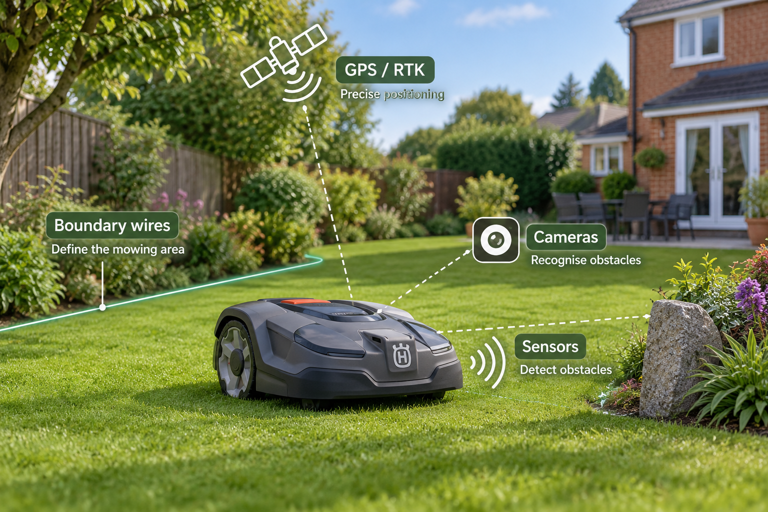
Robot mowers use different navigation systems to understand where they should mow and how they should move around your garden.
Traditional models often rely on a physical boundary wire, while newer wire-free mowers may use GPS, RTK satellite positioning, cameras, sensors or a combination of technologies.
The navigation system affects installation, mowing patterns, accuracy and how well a mower handles complex gardens. Understanding the main technologies makes it much easier to compare models and choose one that suits your lawn.
The quick answer
Boundary-wire systems use a physical cable to define the mowing area. GPS can help a mower understand its location, while RTK provides much more precise satellite positioning for virtual boundaries and systematic mowing. Camera-based systems use visual information to navigate and detect their surroundings. Some robot mowers combine several technologies to improve accuracy and reliability.
In this guide
- Boundary-wire navigation
- GPS navigation
- RTK satellite navigation
- Camera-based navigation
- Sensors and obstacle detection
- Systematic vs random mowing
- Hybrid navigation systems
- Choosing the right navigation system
1. Boundary-wire navigation
Boundary-wire robot mowers use a physical cable installed around the edge of the mowing area. The mower detects the signal from this wire and uses it to remain within the lawn.
This is a well-established navigation method and can provide a clear, reliable boundary. Some models also use guide wires to help the mower travel between different parts of the garden or return efficiently to its charging station.
The main drawback is installation. The wire must be laid around the lawn and may need to be repaired or repositioned if it is damaged or the garden layout changes.
2. GPS navigation
GPS allows a robot mower to estimate its position using signals from navigation satellites.
On its own, standard GPS is generally not precise enough to define exact lawn boundaries to centimetre-level accuracy. Instead, it may be used alongside other navigation methods to help the mower understand where it has already cut, locate different mowing areas or improve route planning.
When a mower is advertised as having GPS, check exactly how the technology is being used. GPS-assisted navigation is different from the more precise RTK systems used by many wire-free robot mowers.
3. RTK satellite navigation
RTK, or Real-Time Kinematic positioning, improves satellite navigation accuracy by using correction data alongside signals from navigation satellites.
This higher level of accuracy allows compatible robot mowers to create precise virtual boundaries and follow systematic mowing routes without a physical perimeter wire.
Some RTK systems require a separate reference station or antenna, while others may receive correction data through a network service. Trees, buildings and other obstructions can also affect satellite visibility, so check the requirements of the individual mower and your garden before choosing an RTK system.
4. Camera-based navigation
Camera-based robot mowers use visual information from their surroundings to help navigate the lawn. Depending on the system, cameras may be used to recognise grass boundaries, identify paths and understand objects around the mower.
One advantage is that camera-based navigation does not necessarily depend on a physical boundary wire or uninterrupted satellite reception.
Performance varies between systems, so consider how the mower handles changing light, shadows, lawn edges and obstacles. Some models combine cameras with other sensors or positioning technologies rather than relying on vision alone.
5. Sensors and obstacle detection
Robot mowers can use sensors to understand their surroundings and react to obstacles while mowing.
Basic systems may use collision or lift sensors, while more advanced models can include ultrasonic sensors, cameras or other detection technologies that help identify objects before the mower reaches them.
Obstacle detection is separate from boundary navigation. A mower may use RTK or a boundary wire to stay within the lawn while using additional sensors to avoid trees, furniture, toys and other objects.
If your garden contains many obstacles, compare the detection technology of individual models as well as their main navigation system.
Ready to compare robot mowers?
Compare robot mowers by navigation technology, lawn size, slope capability, features and price to find models that suit your garden.
Compare robot mowers → Find my mower →6. Systematic vs random mowing
Older robot mowers often use a semi-random mowing pattern, changing direction when they reach a boundary or obstacle. Over time, repeated passes allow the mower to cover the lawn.
Systematic mowing uses positioning and navigation technology to follow more organised routes, often cutting the lawn in parallel lines or planned patterns.
Systematic navigation can reduce unnecessary travelling and create a more uniform mowing pattern. However, the quality of the result still depends on the mower’s navigation accuracy and how well the system handles the layout of your garden.
7. Hybrid navigation systems
Some robot mowers combine several navigation technologies rather than relying on a single system.
For example, a mower may use RTK satellite positioning for precise virtual boundaries while using cameras or other sensors to recognise obstacles and navigate areas where satellite reception is less reliable.
Hybrid systems can provide additional flexibility in complex gardens, but the exact combination of technologies varies between models. Check what each navigation system actually does rather than assuming that more technologies automatically mean better performance.
8. Choosing the right navigation system
The best navigation system depends on your garden rather than simply which technology is newest.
Boundary-wire systems can suit gardens where a fixed physical boundary is practical. RTK can be attractive if you want precise virtual boundaries and systematic mowing, provided your garden offers suitable satellite conditions. Camera-based systems may be useful where visual navigation can reduce reliance on satellite positioning.
For more complicated gardens, consider whether a mower combines multiple navigation technologies to handle boundaries, positioning and obstacles.
Compare the navigation system alongside your lawn size, slopes, layout and installation preferences before deciding which robot mower is right for you.
What matters most
- Boundary wire — A proven way to define the mowing area using a physical cable.
- GPS — Useful for positioning and tracking, but standard GPS alone is generally not precise enough for exact virtual boundaries.
- RTK — Provides much more precise satellite positioning and can support virtual boundaries and systematic mowing.
- Cameras and sensors — Help the mower understand its surroundings and detect obstacles.
- Garden conditions — Trees, buildings, lawn layout and installation preferences can all affect which navigation system is most suitable.
Find the right robot mower for your garden
Compare robot mowers by navigation technology, lawn size, slope capability, features and price to find the models that best suit your garden.
Find my mower →